Policy
Outdated flood data could drown out actual infrastructure needs
Historical data fails to capture current flooding conditions, which could steer communities in the wrong direction when trying to plan and recover from weather events.
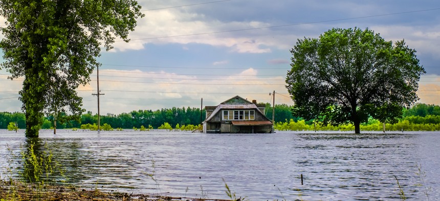
Lana2011/Getty Images

The frequency of climate-driven weather events is expected to increase, but state and local governments are ill-prepared to handle them, according to a new report.
While there are advanced data tools that help leaders anticipate when and where natural disasters such as flooding may strike, they often rely on historical data that may not provide an accurate reflection of current and future climate trends, researchers at First Street Foundation, a nonprofit dedicated to climate technology and research, said in a June 26 report.
For instance, the National Oceanic and Atmospheric Administration’s Atlas 14 resource offers an analysis of expected rainfall across the country, and is often used to determine infrastructure decisions meant to protect communities from flooding. However, Atlas 14 analyses fail to consider continuous changes in climate data, according to the report, which could lead to misguided infrastructure investments based on inaccurate data that end up wasting taxpayer dollars.
“The consequences of not understanding these changes include overwhelmed stormwater systems that lead to residential and commercial flooding, impassable roads, critical infrastructure failure, and even loss of life in unexpected high-intensity flash flood events,” said the report.
More modern data and climate models, however, enable better-informed infrastructure preparedness and flood risk assessment and management. With timely data, leaders can better prevent property damage and unnecessary deaths during major flooding events, the report stated.
That’s why researchers developed the First Street Foundation Precipitation Model, which includes early 21st-century rainfall records, giving users an updated projection of rainfall frequency nationwide.
For example, the model projected that the estimated precipitation risk in some areas in California, Nevada, Oregon and Washington are 50% lower than originally thought, meaning those communities may be building infrastructure that does not match the severity of flood risk and exerting resources that could be better served elsewhere.
“What this means for communities today is that their understanding of risk is often underestimated,” said the report, “and in many locations the infrastructure in place or that is currently being built to protect communities, property and individuals is built to an insufficient standard.”
“For any federal, state or local actions that may be taken to address the impacts of climate change and to improve our communities’ resilience in a changing climate,” the report continued, “the availability of relevant, accurate information is key to enabling informed policy- and decision-making.”
A version of this story was first published on Route Fifty.
NEXT STORY: Federal judge temporarily blocks parts of Florida elections law